China has a huge land area and abundant resources. Many people are keen on traveling and hiking. These 10 routes are the most popular in outdoor travel routes.So the Top 10 Outdoor Crossing Lines In China are these:
1.Dian Bei Chuan Nan Cross Road Crossing Route
Locke Road crosses the route, starting from Lijiang, passing through Muli, Aden, and finally to Daocheng.
As for the origin of this route, the Americans Joseph Locke crossed this road in May 1924, and took a lot of precious photos along the way. Later, he published this experience in National Geographic magazine and made a sensation. Now the Locke Road crossing route has become the legendary road in the minds of explorers all over the world.
2.Jiangxi Wugong Mountain Crossing

Located in the central and western part of Jiangxi Province, Wugong Mountain is one of the most popular routes in the entire East China region. The main peak of Wugong Mountain is only 1918 meters above sea level.
Alpine meadows and sea of clouds are a major feature of Wugong Mountain, so it is worthwhile to try it yourself.
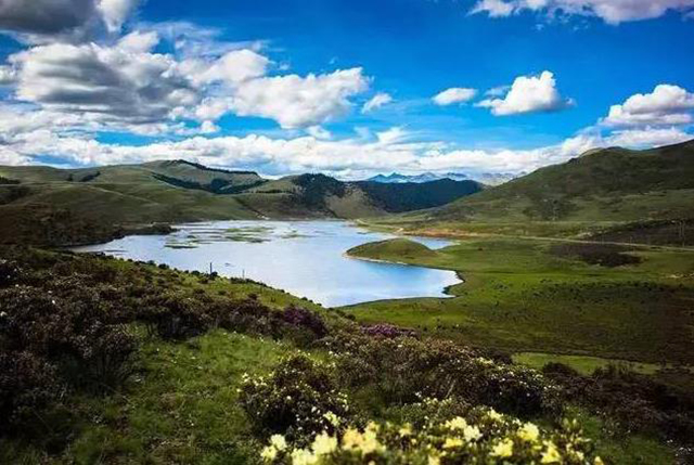
3.Qinghai Nian Bao Yu Ze Crossing
Yu Ze is located in the eastern section of the Bayan Hara Mountains in Qinghai Province. The main peak is 5369m above sea level. Here, even in July and August, you can feel the four seasons of wetland meadows, valley pastures, clear streams and frozen snow-capped mountains.
Because of the beautiful scenery, the hiking index here is also very high, often used to compare with the Locke route. I can walk here, I really feel that my eyes are in heaven and my body is in hell.
4.Xinjiang Wusun Ancient Road Crossing
The Wusun Ancient Road is bounded by the Junggar Basin in the north and the Tarim Oasis in the south. It is the throat that runs through the north and south of the Tianshan Mountains and has a very important position in history.
As one of the top three hiking routes in Xinjiang, it has high requirements for physical endurance. The whole route is about 130 kilometers, and it has to climb over the highest altitude of 3,800 meters. It is the most extreme test of psychology and physiology.
5.Xinjiang Xiate Ancient Road Crossing
As one of the top three hiking routes in Xinjiang, the Chate Trail is a high-risk hiking expedition. The ruins of the fragmented Muzart, the ice gap, the glaciers, and the raging South Muzart River will make a great impact. Threat.
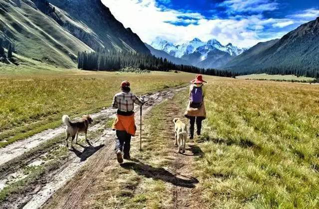
Due to the geomorphological reasons, the passers-by can only carry their own luggage, which is a big test for physical strength and endurance in high-altitude mountains.
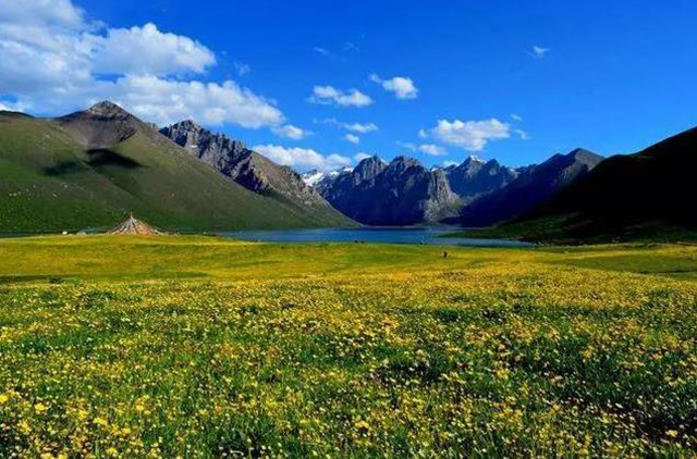
6.Sichuan Siguniang Mountain Changpinggou to Bi Penggou Crossing
Siguniang Mountain is known as the Chinese Alps. In this crossing route, the route from Changpinggou to Bipinggou is the most classic.
The starting point of this crossing route is the Changping Village entrance, and the end point is the Bishangoukou 309 Forest Farm. The whole journey is as large as 111 kilometers. The route is difficult but the scenery is definitely one of the best in China.
7.Tibet Medog Crossing
Medog County in Tibet is located in the lower reaches of the Yarlung Zangbo River, in the southern part of the Himalayas, and in the southern part of the Himalayas. The Tibetan language means “the place where the hidden lotus blooms”.
In Medog, there are many types of virgin forests and rich species. It is famous for being the last county in China that does not have access to highways, and because of its difficult roads, it has been praised by many friends. Therefore, hiking Medog has become the ultimate goal of many backpackers.
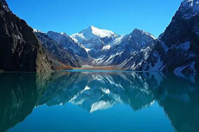
8.Sichuan Gongga Mountain Crossing

Gongga Mountain is located between Kangding, Luding, Shimian and Jiulong counties in Sichuan Province, with an altitude of 7556 meters. It is the highest mountain in Sichuan Province.
The peak of Gongga Mountain is dense, and the ice is strong and snowy. It is one of the most developed mountains in China’s maritime mountainous glaciers. It plays an important role in mountaineering and scientific research. It is called more dangerous than Mount Everest. mountain peak.
9.Shaanxi AoTai Line Crossing
Qinling crossing is one of the top ten difficult crossing routes in China, and Ao Mountain crossing Taibai is the first top line of Qinling.
The distance between Ao Mountain and Taibai Mountain is more than 40 kilometers, and the actual crossing time is about 100 kilometers. On the way, the altitude increased from 1,740 meters in Taibai County to 3,475 meters in Ao Mountain, and then 3,523 meters from Taibai Mountain to 3,767 meters in the main peak of Taibai Mountain. This line has a variety of climates and complicated road conditions. Most of the trips are hikes in the glaciers and it is very dangerous to encounter bad weather.
10.Xinjiang Wolf Tower C crossing
The Wolf Tower crossing route refers to the dangerous hiking route through the northern Tianshan Mountains in Xinjiang. The Wolf Tower line starts from the Hutubi River Grand Canyon in the Changji Hui Autonomous Prefecture of northern Xinjiang. It climbs from the north to the south and reaches nearly 4,000 meters of Dalai and then arrives at Baring Terrace in Hejing County, Bayinguoleng Mongolian Autonomous Prefecture. The total walking distance is about 120 kilometers.
There are many crossings of the Wolf Tower, but only the C and D lines are complete lines through the Tianshan Mountains. The crossing time is generally 6-8 days. The Wolf Tower C line is the most dangerous walking route through this area. Today, the Wolf Tower C line and the Shatt Trail and Wusun Trail are called the top three hiking routes in Xinjiang.